
survey equipment V30 GNSS RTK SYSTEM

Ann Yuan
Contact person
Basic Information
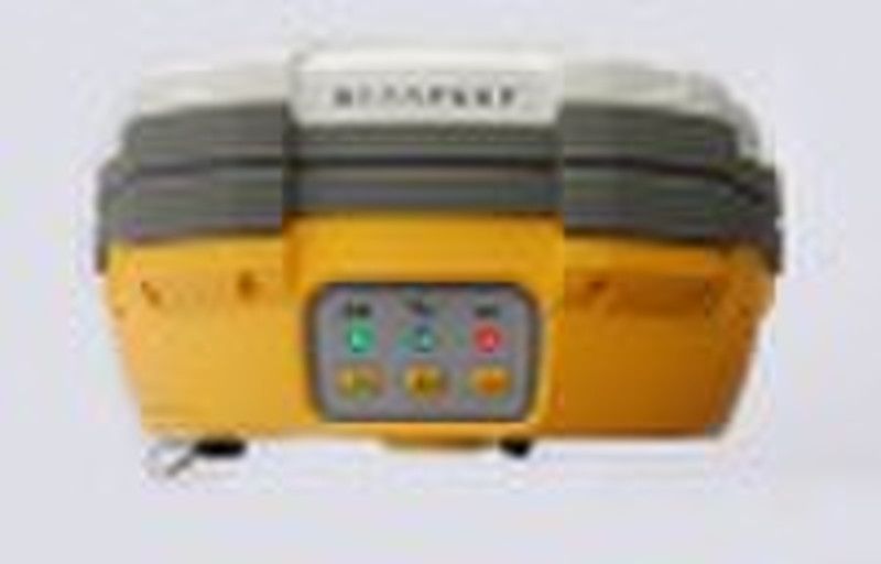
survey equipment V30 GNSS RTK SYSTEM 1.Built-intransmit-receiveUHF,exchangeableBaseandRover. 2.Theradiopowerisadjustabletobe0.1w,1w,2w. 3.1+Xmulti-modulecommunicationunits. 4.PCCRadiomodule(optional)compatiblewithTrimble/LeicaRTK. 5.Doublebatterycapacityas4400mAh,12hoursforRTKoperating. 6.Thehighestperformanceinwaterproof,dustproofandanti-drop. 7.TrimbleBD970motherboard,multi-satellite,multi-systemkernel. 8.Supperlongdistanceexternalradio(optional). 9.Withtheintelligentializedself-diagnosisfunction 10.ConfigMulti- functionRTKcontrolleriHand1series.VoicenavigationofRTKhandheldsoftware. ThecombinationofthetopGNSSindustry’stechnologies,V30givesyoucompletelyinnovativeuserexperiene. Application: ConstructionLayOut Abundantpointandlinelayoutfunction,assistantbygraphoperationinstruction,saveyour expenditureinpracticalconstruction. ElectricityandTransportation Friendlyfunctiononpowerlineroutedirectionsurvey,distancesurveyandanglecalculation; comprehensivesurveyfunctionalityonroadsurvey,centerline,offsetsurvey,profileandcross-sectionsurvey. CORSApplication SeamlesslycompatiblewithCORSsystem,onlyoneRTKrovercanreceiveCORSdifferencesignal andcarryout datacollection,constructionlayoutwork. CORSStationEstablishment HD-CORSapplyprofoundexperienceandmutualtechnology,stableonoperation,longdistanceon datatransmission,isyourfirstchoiceforcitycontinuousreferencestationssystem. ControlSurvey Onlyoneinvestmentyoucangetlistoffunction,v30dualfrequencystaticsurveyaccuracycan satisfyanyrequirements,configwithmutualprofessionaldatasolutionsoftware.Youcaneasily accomplishvarioushighprecisioncontrolsurveywork. Dataconllection CotrolleroperationsoftwaredesignedforGISapplication,convenientcodingfunction,meetsall yourrequirementsinfielddatacollectionwork.
Delivery terms and packaging
Packaging Detail: with case in carton Delivery Detail: depend on the quantity of your order
Port: SHENZHEN/HONGKONG
Payment term
Letter of credit
Telegraphic transfer
Western Union

-
Payment Methods
We accept:


